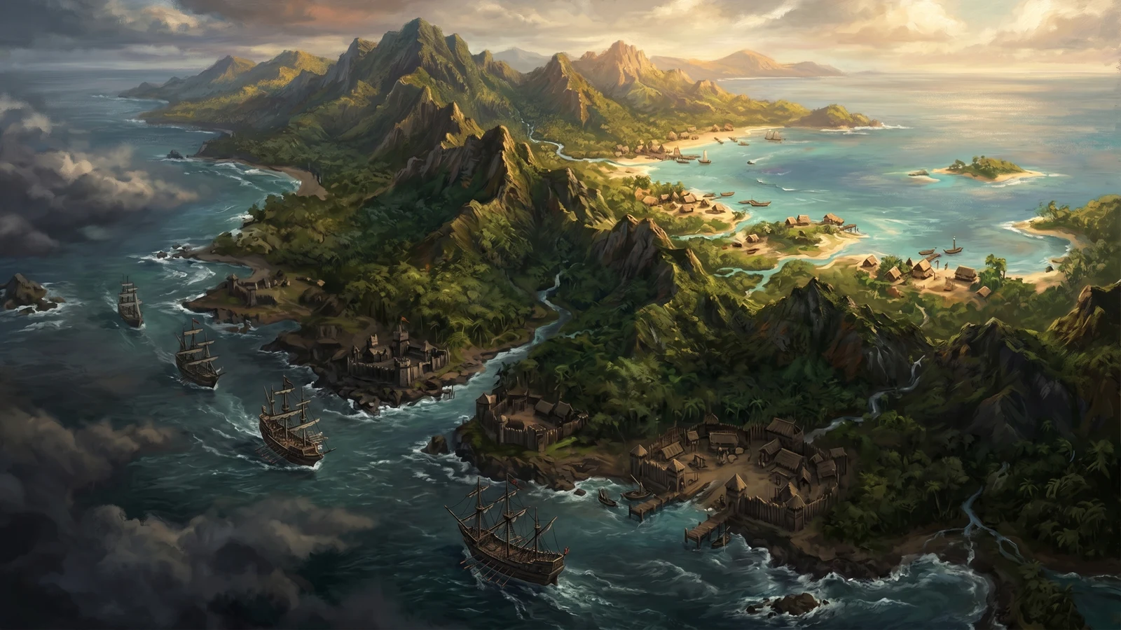
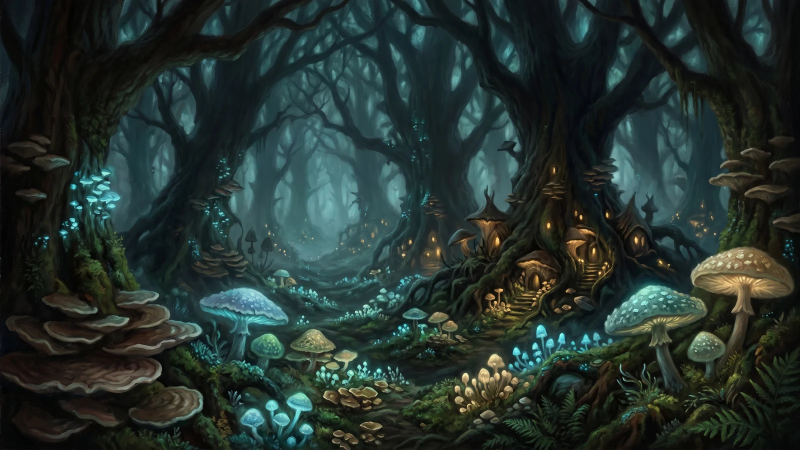
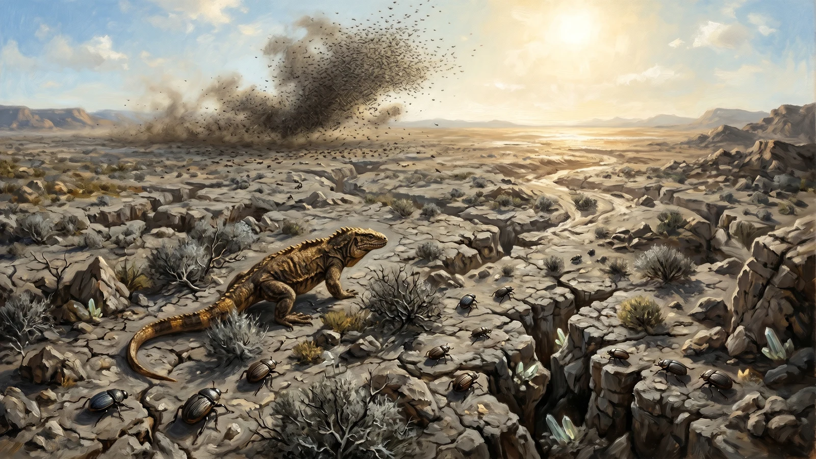
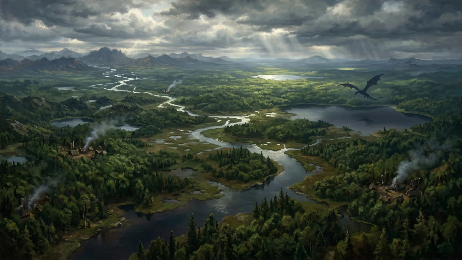
geography
440 entries bear this mark.
Agorf Island
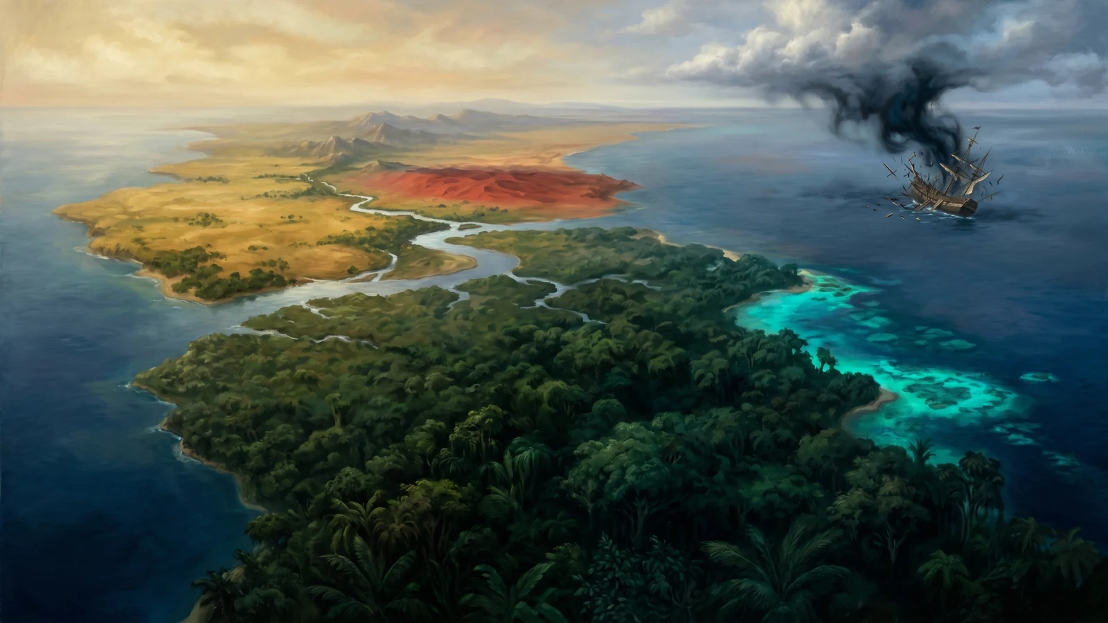
An island south of Pesalolo across the Torgan Passage; slave ships bound for Azantir thread the strait along its shore or round the island entirely.
Aikon Tidal Islands
A chain of low-lying islands north of Sheîr where the tides reshape reality twice daily.
Ayashk Island
A rocky archipelago in the Deaddore Strait, home to the Free Colonies.
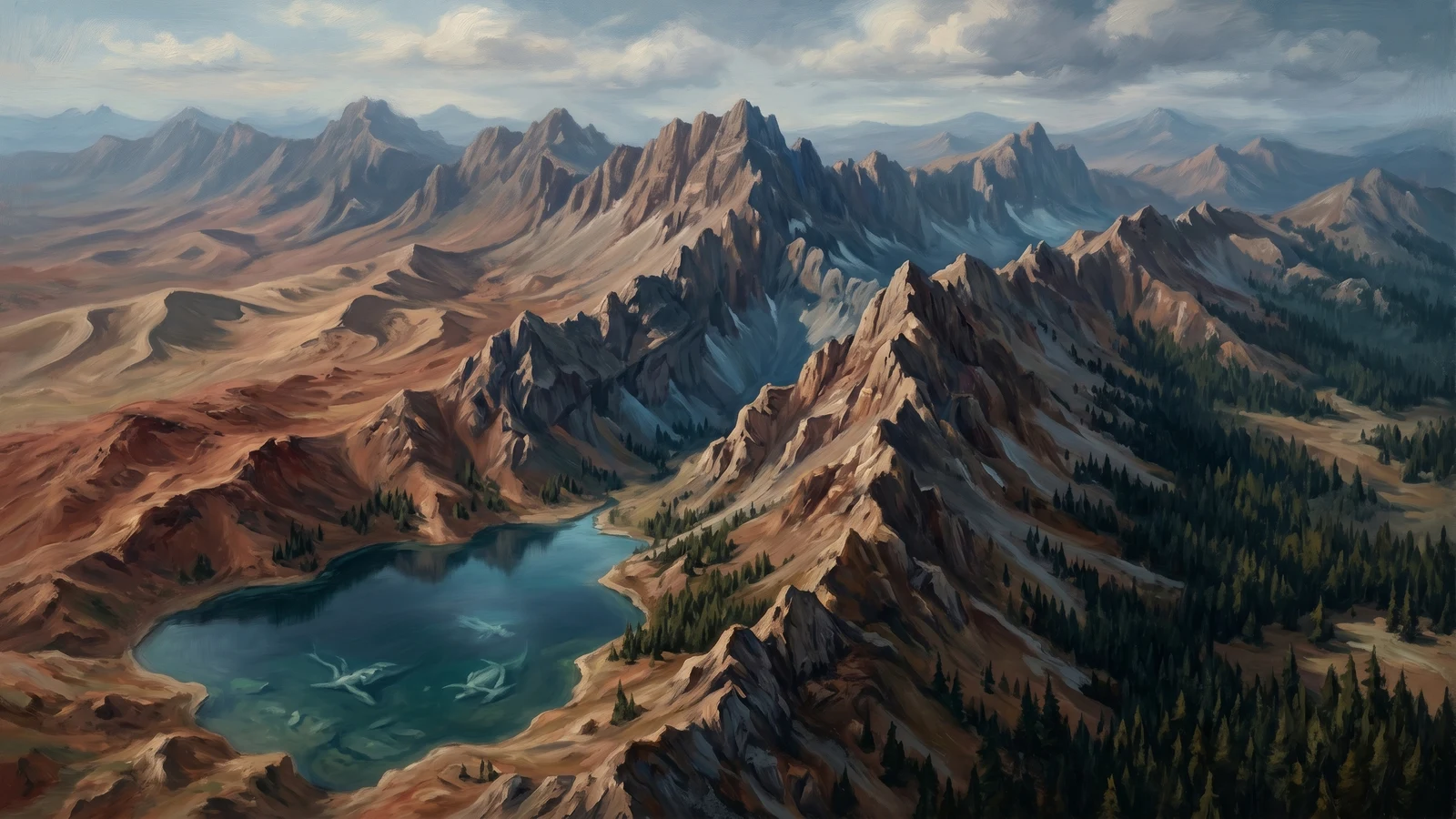
Bellowing Mountains
A harsh range of peaks in the eastern Dragon's Spine, rising between the Hills of Sarrow to the north and the Pale Peaks to the…
Buffalo Islands
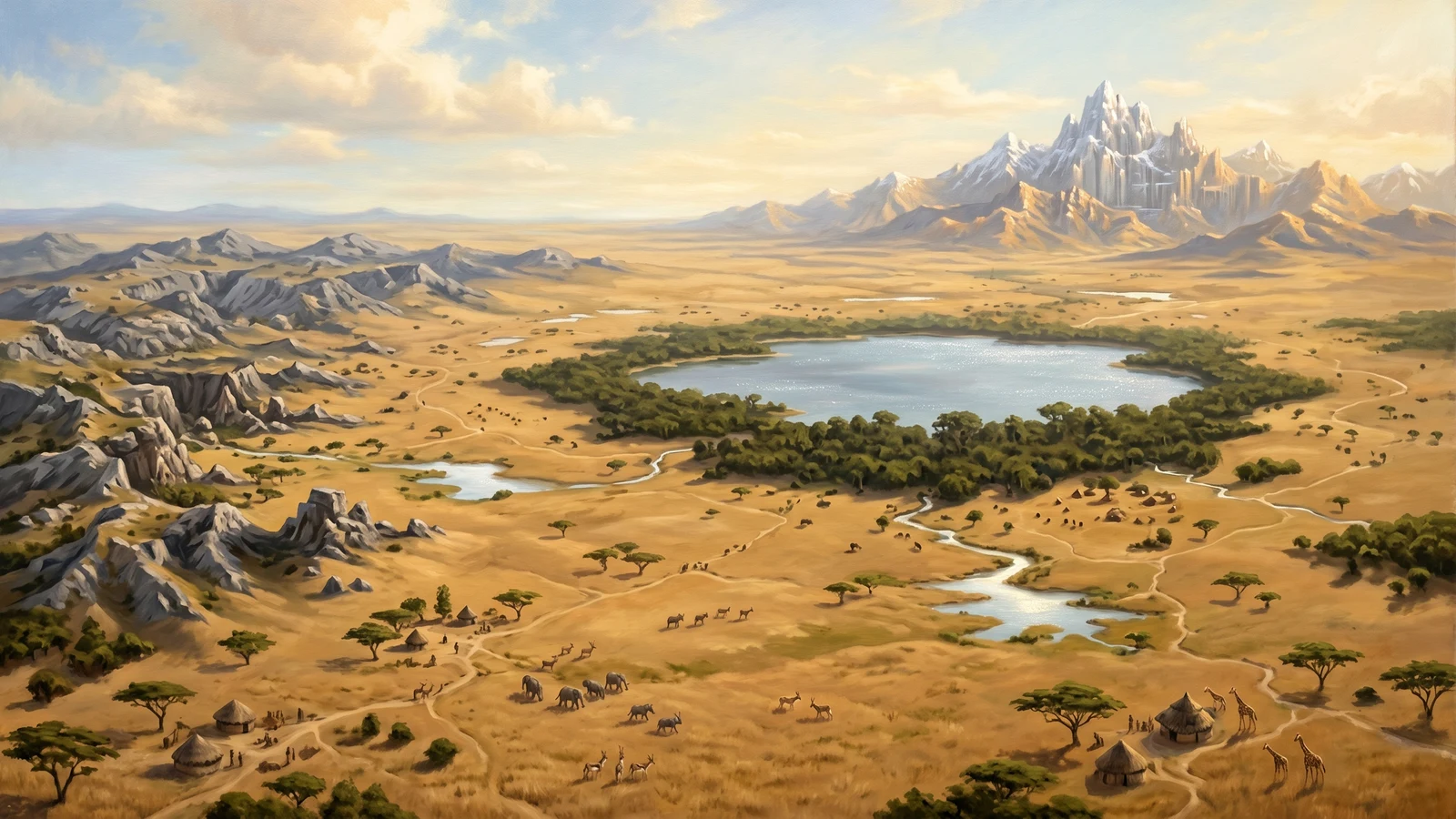
Central Aboyinzu
Central Aboyinzu is the vast interior of the continent—a general term encompassing the savanna heartlands, the Deadloop inner sea, and the territories between the major…
Crab Island
An island in the Agreben Sea.
Dalizi Wildlands
A lake in the Dalizi Wildlands.
Dragon's Spine Coast
Dragon's Spine is the long, misty, snow-covered mountain range that runs east-west across the entire southern edge of Aboyinzu.
Dragon's Teeth
A group of islands in the Western Isles.
Dragonsong
The forested eastern third of the Wanderlands, filled with the low hum of Dragon's Gate and ruled by the dragon Ziru.
Dunes of Evioli
A sea of sand hiding an empire of orange.
Elder Wilds
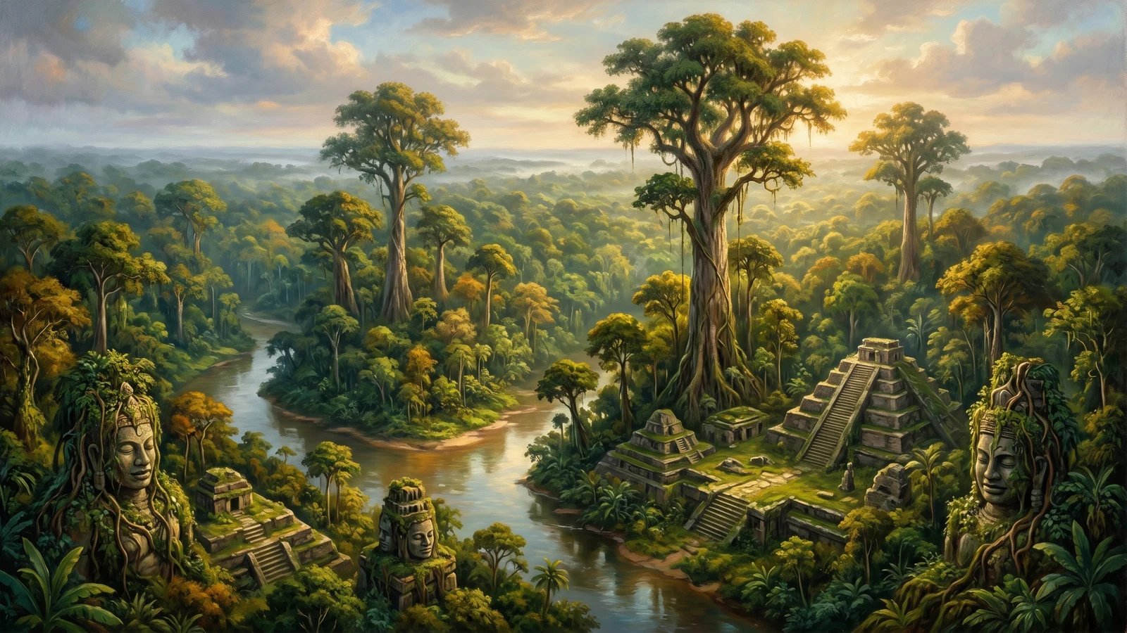
The Elder Wilds occupy the entire eastern peninsula of Aboyinzu—a vast region of ancient rainforest, winding rivers, and primordial wilderness.
Ember Isles
A volcanic island chain in the southwestern Western Isles, where the earth still burns and ancient Neferati experiments left scars that haven't healed.
Erpeus
Erpeus is a major island in the Middle Sea, positioned between Ofrenia to the east and the mainland to the west.
Farlands
The Farlands occupy the western coastal region of Upoceax—a vast stretch of land running nearly 600 miles from north to south.
Frostwing Island
A large island off the southeastern Dragon's Spine Coast, separated from the mainland by roughly five miles of treacherous water.
Glyn'Qoth
Gray Isles
Islands in the Gray Sea.
Gyosha
An island off the Seacleft Coast.
Innerrim
The Innerrim is the vast jungle basin at the heart of Rimihuica—a dark green sea of dense forest filling the continental interior.
Islands of Gold
The southernmost archipelago of the Western Isles—fantastically rich in gold and utterly deadly to reach.
Kobuk
Kobuk is a rugged mountain territory in the central Wurmspine range, bounded by the Hellion Hills to the north and the Hills to Nowhere to…
Lyoki Ingi Ingi
A dense rainforest peninsula stretching south from the Shacklands interior, where the Mudzwiti goblins have built a civilization around death, dinosaurs, and the slow accumulation…
Midton
A small, rocky island in the eastern Tarkhon Passage, home to Ekfusy fortress and little else.
Migos
A small, craggy island in the northern Western Isles whose one good harbor—and only real power—is the city-state of Iypos.
Movasi
A large island in the southeastern Greenwater Isles, Movasi is covered almost entirely by the Dream Jungle—a bioluminescent forest where the boundary between waking perception…
Ofrenia
The largest island of the inner Middle Sea, a strategic crossing held by three sibling-kingdoms locked in a barely-managed feud.
Pesalolo
A thousand-mile island running northeast to southwest, split in half by geography and politics alike.
Phenol
Hills on Phenol.
Phriorys
The northwestern edge of the Dygon Beastlands, where the jungle breaks against a landscape of rolling hills, scattered groves, and open grassland.
Phyr Island
A jungle island in southeastern Ve, separated from the mainland by the treacherous Disaster Passage.
Pindolin Islands
A sprawling archipelago stretching roughly 800 miles east-to-west and 500 miles north-to-south off the Dragon's Spine Coast, where the mountain range fragments into the sea…
Porizzon Island
Prophecy Island
An island in the Agreben Sea.
Pyris
A moderate-sized island southwest of the Tarkhon Strait, part of Nektuna's territory.
Roule
A broad peninsula and island chain in the southern Greenwater Isles, Roule is the heartland of halfling colonial power.
Sandreach
Sand Reach is the massive desert that stretches across the entire northern portion of Upoceax, extending all the way to the northern coast.
Sandreach Mountains
The Sand Reach Mountains are the vast central mountain range of Upoceax, positioned south of the Sand Reach desert.
Satyr Lands
A region inhabited by satyrs in Central Aboyinzu.
Shinori Island
The largest island in the northern Pesalolo archipelago, and the lair of Agtakkeri the Flayed Banner.
Shir
An island standing alone in the channel between the northern mainland and the Sunshine Coast, walled off by the Scream Strait and the Lightning Passage.
Soros
An island in the Western Isles.
Starfish Isles
A sprawling archipelago of low-lying islands, sandbars, and reef systems stretching north of Enavadi into open water.
Strymün Island
The Strymün Isles rise from the Gindrik Sea like green jewels set in blue-gray water—a cluster of volcanic islands whose peaks remain visible for miles…
Tarkhon Empire
The Tarkhon Empire straddles the critical strait between Clueanda and Rimihuica, controlling territory on both continents and dominating the only sea passage between the Middle…
The Twins
Two contrasting islets off the southwest — one windswept rock, one sheltered scrub — used by seasonal fishermen.
Torguli Islands
A long, curving chain of islands stretching southwest from the main Tyvern archipelago into open water.
Tykos
Tykos is an island chain south of Erpeus, home to minotaur clans who've practiced slavery for longer than most civilizations have existed.
Tyvern Isles
A group of islands off the Seacleft Coast, home to the Tuktuk people.
Urok
A large island in the Greenwater Isles.
Ve
The isolated continent of the far east, walled off from the rest of Alaria by open ocean: dry savannah and desert in the north, deep beast-haunted jungle in the south.
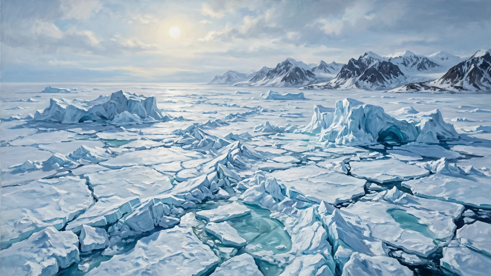
Venalthier
Venalthier is the frozen polar region occupying the extreme southwest of Upoceax.
Western Isles
The Western Isles occupy the waters between Clueanda to the north and Rimihuica to the south, marking the edge of the known world to the…
Westrim
Westrim occupies the northwestern quadrant of Rimihuica, dominated by the massive Dunes of Kunagi desert and ringed by mountains and deadly jungles.
Westwilds
The Westwilds occupy the southwestern corner of Clueanda, forming a transitional zone between the frozen Northlands and the maritime regions to the south.
Wycendeula
Wycendeula encompasses the entire southern portion of Upoceax—a vast region stretching from the Eceraen Mountains in the far south (above Venalthier) northward to the Sand…
Xabraedia
An island east of the Free Isles, across The Spout channel.
Xibli Islands
A scattered archipelago east of the Aikon Tidal Islands, where the inhabitants have built their entire culture around competitive gift-giving.
Agreben Sea
The northern waters of the Greenwater Isles archipelago—a warm, teal-colored sea bounded by Mueras to the north, Atriik to the east, and the great island…
Akratian Plateau
The southernmost landmass of Venalthier—a windswept plateau extending toward the polar ice cap, where the boundary between land and permanent sea ice becomes impossible to…
Bay of Wolves
A deep inlet cutting into the western coast of Wycendeula, framed by the Wolfmaw peninsula to the south and forested headlands to the north.
Belanora
A rugged hill country along the western edge of Meadow Sound, separating the coastal waters from the interior jungles.
Belanorn Bay
A sheltered bay at the western end of Meadow Sound, where the Misery River deposits its waters into the sea.
Blackpits
A sprawling swamp in the north-central Dygon Beastlands, where dark water pools beneath a broken canopy and the dead do not always stay dead.
Blisterswamp
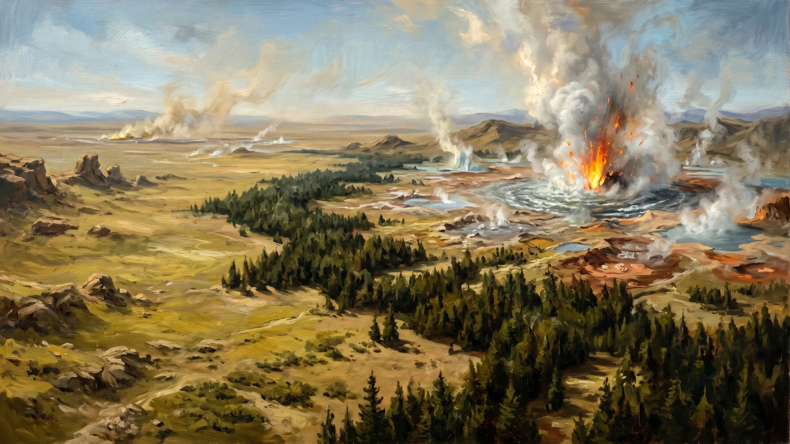
A caustic wetland near the western edge of the Krell Lands, where geothermal activity creates bubbling pools of acidic water that nothing—not even the Krell—can…
Blood Mountains
The southernmost reach of the Widebarrow Mountains, the Blood Mountains take their name from the deep crimson iron ore veins that streak through the rock—and…
Bloodlands
The scarred buffer zone between Atriik's southern reaches and the Ishnit Jungles, where generations of warfare between the Kor/Sharabha city-states and the Naruaghin tribes have…
Bloodswamp
The Bloodswamp is a large wetland in southwestern Kadroka where the region's major rivers converge before flowing into Tytheri territory.
Bluesong Bay
Bluesong Bay is a large inlet on the western coast of Central Aboyinzu, notable primarily for who doesn't use it.
Blyss
The eastern reaches of the Dygon Beastlands, where the jungle grows thickest and the canopy blocks nearly all sunlight.
Bone Hills
The Bone Hills rise from the southern edge of the Salt Flats—a low range of weathered ridges that mark the transition from salt pan to…
Butterfly Forest
A vast woodland blanketing the lowlands between the Sunset Mountains and the Vokas Enrisikna range.
Byvarnül Lake
A broad, shallow lake in the southeastern reaches of Luendrokrül, roughly fifteen miles across at its widest point.
Carcass Hills
A range of low, bleached hills rising from the southern Fylvrae Sylvrym, where the forest thins before meeting the Kilbyurn foothills.
Carya Nairn
A small region in the southern Kelder foothills, between Eshbya Hills and Tomgryir Eror.
Chakatann
A region of the western Piktiniti Desert defined by the Postronamas pillars—massive stone columns hundreds of feet tall, spaced roughly ten miles apart in a…
Chitin Cove
The only safe landing point on the Krell Lands coast, Chitin Cove is named for the cast-off exoskeletons that wash up on its beaches—debris from…
Cliffs of Shondromos
A secondary cliff formation west of the Cliffs of Syquindonos—smaller but equally treacherous, marking where the Stratlan Sea meets the Western Isles.
Cliffs of Syquindonos
A dramatic wall of stone marking the northern boundary of the Western Isles—sheer cliffs rising hundreds of feet from the Iron Sea, carved by millennia…
Cloud Mountains
A mountain range forming the southern boundary of Eoga and the northern edge of the Innerrim highlands.
Copper Hills
Low, scrubby hills in western Kerwin, rich with copper ore.
Crocodile Coast
The eastern shore of Phirexes, where the Whispering Mangroves give way to open water and the mists finally thin enough to see the horizon.
Crystal Coast
The northwestern shoreline of Venalthier, where the Scepter Mountains descend into the Dismar Deep.
Crystal Mountains
A fifty-mile spine of peaks running northwest to southeast through Central Aboyinzu, separating Terrenia and the horrors of Chaal Nazzerox from the forests of M'Svyla…
Cydoris River
A seasonal lifeline through dying hills.
Deadjack Forest
Deadjack Forest is a dense woodland in southeastern Kadroka, positioned between the Fury Hills and the approaches to the Agony Stones.
Deadloop
A vast inland sea surrounding Mikisapi Island, connecting Donclik Sound to the interior waters of Central Aboyinzu.
Deadman's Lake
A cold mountain lake nestled in the northern Kilbyurn foothills, where the forest begins to thin and the terrain rises toward the high peaks.
Desendrum Mountains
A rugged north-south ridge in the central Westwilds, the Desendrum range marks the transition between the forested west and the open plains to the east.
Desert of One Million Shards
The Desert of One Million Shards is the scarred remains of The Scorching of Clueanda, a catastrophic breach of the Yolus plane approximately 25,000 BSD.
Dnykuul
A rugged hill country in the Sandreach Mountains, positioned between Breia to the north and the Scarlet Peaks to the east.

Donclik Peninsula
A windswept finger of land extending north into Donclik Sound, notable primarily for being uninhabitable.
Donclik Sound
A large bay on the northern edge of the Wanderlands, bounded by the Donclik Peninsula to the east and the mainland coast to the west.
Drakwald Forest
A silent woodland in Rakite's southwestern corner; the herds will not cross its treeline, and the Rakiten, who name it weklis-void, will not enter.
Dreske Gemalis
A rugged mountain range marking the western border of Nashua, where the Inner Rim transitions from the highland territories to the toxic lowlands.
Droughd Sound
The gateway to Gnotobi's empire.
Drystone Mountains
A major east-west mountain range within the Sandreach Mountains system, running through the central portion of the range.
Dustwind Plateau
The arid heart of Mueras, a high tableland swept by winds that never cease.
East Whitewall
The first major face of cliffs in Venalthier, home to the Nabuhe dwarves who have carved extensive mining operations into the frozen stone.
Eberri Ygonzi
The great forest of southwestern Wycendeula—a dense expanse of ancient conifers and tangled undergrowth stretching from the Neurian Hills to the edge of Kama Sa'malina.
Eceraen Mountains
A rugged east-west mountain range forming the southern boundary of Wycendeula, separating the forested lowlands from the frozen wastes of Venalthier beyond.
Echem Yiakraxes
A vast killing ground in northwestern Central Aboyinzu, Echem Yiakraxes is Terrogone territory—and everyone knows it.
Edko Sound
The sheltered waters between the Floss Islands and the Enavadi coast, Edko Sound is the heart of Enavadi's fishing industry.
Ekri Towers
Twin spires of dark stone rising from the ice plain between Morelous and the Selengreyb Plateau—the only structures in Venalthier's interior, standing where no structures…
Ektolmni Grif
The transitional hill country between Vokas Enrisikna and the Tyror plains—broken terrain where the mountains give way to grassland in a tumble of ridges, draws,…
Endari Hills
The transitional highlands between the forests and the lakes—a band of rolling terrain separating Eberri Ygonzi from the northern reaches of Kama Sa'malina.
Eshbya Hills
A region of low hills in the southern foothills of the Kelder Mountains, within Deo Esari's claimed territory.
Everwood
A vast forest stretching across the southern Krenglelan Range and into the lowlands beyond, the Everwood is not a forest in any normal sense—it is…
Extolmni Furis
Forested hills in the central part of Rakite, where the Ver Pes river cuts through rising terrain between the Ektolmni Grif and the plains proper.
Eyendra
The Eyendra is one of Alaria's great forests—a vast expanse of boreal woodland stretching across southeastern Wycendeula, from the Eceraen Mountains in the south to…
Ezra's Temptation
A winding river that flows through the eastern portion of Milrar Forest before emerging onto the Steppe of Aziirn, named for a legendary explorer whose…
Falsehaven Bay
A broad, sheltered bay on Central Aboyinzu's western coast, where Satyr Wood meets the sea.
Fatiik Forest
A transitional forest in central-southern Atriik, straddling the border between settled Kor lands and the contested Bloodlands to the south.
Fernius Sound
The body of water east of Petrona Septia Island, separating the island from the scattered archipelagos and open waters beyond.
Firefrost Hills
A transitional zone between the southern Caffas Mountains and the White Wastes, where the elevation drops from mountain heights to the flat expanse of the…
Fireknife Mountains
Part of the greater Wurmspine range, the Fireknife is a volcanic segment along the northwestern border of Kerwin, marking the boundary between settled Tarkhon territory…
Floating Islands of Aleve Akribus
A cluster of islands that hang suspended in the air above the sea, southwest of the Torguli Islands chain.
Forest of Avarice
A dense, ancient woodland marking the eastern boundary of Echem Yiakraxes, the Forest of Avarice earned its name from the prospectors and treasure-hunters who enter…
Fury Hills
The Fury Hills are a range of rugged highlands in southeastern Kadroka, forming part of the border zone between Kadrokan territory and Tythikerys.
Fylvrae Sylvrym
One of Alaria's largest continuous forests, Fylvrae Sylvrym blankets the western half of Wycendeula—a sea of ancient trees stretching roughly 700 miles north to south…
Fyrsan Al Troikas
A jagged mountain range forming the eastern boundary of Satyr Wood, running roughly north-south for over a hundred miles.
Gaplands
A stretch of open terrain west of The Glog where the Dragon's Spine briefly relents, creating the only significant lowland passage along this section of…
Giants Cradle
A bowl-shaped valley nestled between the Koilos and Myjornis mountain ranges, containing two sacred lakes central to giant spiritual tradition.
Glory River
The sacred waterway of Sestros, flowing from the foothills of the Shepherds' Stones through the kingdom's heartland.
Golden River
The most profitable waterway in Ve.
Goldwood
A sacred forest in western Avalon, between the settled heartland and Munari Inlet.
Grand Tolkarsus
The longest river in the Westwilds, the Grand Tolkarsus stretches from the Nirvanis Mountains (part of the Kharvorn range) in the northeast, flowing southwest through…
Gray Hills
A low range of hills in central Grendenheim, marking the transition between the open meadowlands and the Dragonsong forest to the east.
Green Mountains
The Green Mountains form the spine of southern Windor, a rugged barrier separating the halfling lowlands from Poum Titch and the lands beyond.
Green Wilds
The Green Wilds are what the Ishnit Jungles become when they thin enough to walk through—still dangerous, still wild, but no longer the impenetrable deathscape…
Grelli Hills
A sprawling highland region in the northwestern Westwilds, the Grelli Hills form a natural boundary between the Walking Forest to the south and the open…
Grendel Inlet
A shallow inlet extending south from Donclik Sound, separating the Donclik Peninsula from the Wanderlands mainland.
Grieb Lakes
A series of freshwater lakes in the hills of the northeastern Wildwood, home to the Griebi people.
Grognil Mountains
A rugged mountain range in the southwestern Sandreach Mountains system, positioned between the Caffas Mountains to the east and the lowlands descending toward Wycendeula.
Gulf of Norag
A warm, shallow gulf where the Greenwater Isles meet the mainland coast of the Ishnit Jungles.
Gulf of Tears
The body of water separating Phirexes from the broader Emerald Coast region to the northwest, where the Sweet Water River empties into the sea and…
Gyerekas
The southern boundary of the Dunes of Kunagi, where the sand sea breaks against a range of low, strange hills that aren't hills at all.
Hardshell Mountains
A diagonal range running through the northern Krell Lands, the Hardshell Mountains are the insectoid heartland—the most densely populated Krell territory on Ve.
Hellion Hills
The Hellion Hills mark the northwestern terminus of the Wurmspine range, where the great mountain chain fragments into a chaotic jumble of volcanic peaks, smoking…
Hills of Dolor
The hills where the nameless come to die—or to begin again.
Hills of Sarrow
Low, windswept hills stretching north of the Bellowing Mountains, marking the transition between Gondurak's territory and the broader Dragon's Spine.
Hills to Nowhere
The Hills to Nowhere occupy the southern reaches of the Wurmspine range, a desolate highland region stretching from Kobuk in the north to the arid…
Homdrum Hills
A low, rolling highland region east of the Desendrum range, the Homdrum Hills (sometimes rendered "Humdrum Hills" on older maps) earned their name from their…
Honor Creek
A tributary of the Honor River, branching northeast through Shorolyn Forest before joining the main watercourse.
Honor River
The central waterway of Avalon, flowing from the eastern highlands westward through the kingdom's heart before emptying into Munari Inlet.
Howlwood
A dense forest sprawling across northeastern Edari, where the golden savannah gives way to thick woodland near the coast of Coquray Sound.
Husakas
The southwestern reaches of the Dunes of Kunagi, where the sand sea breaks against the ancient fossil hills of Gyerekas and thins toward the Spotted…
Iqes Sound
The body of water south of Iqes, between the island and the Upoceax mainland.
Ishnit Jungles
The lethal jungle ringing the southern Dunes of Kunagi, ruled in pieces by two false-dragon gods, three Naruaghin confederations, and a bottomless rift.
Jungles of Godahi
The Jungles of Godahi form the vast interior basin of the northern Emerald Coast—a sea of green canopy stretching roughly 300 miles east to west…
Jüt
A port city of roughly twenty thousand people positioned on Kettle Bay, where the Westwilds coast meets the sea.
Kama Sa'malina
The lake district of southern Wycendeula—hundreds of bodies of water scattered across roughly three thousand square miles of boggy forest and scrubland, pressing against the…
Kelder Mountains
The bracket-shaped range along the eastern Farlands, a titan graveyard whose buried bones are the source of most of the world's titan bone.
Kettle Bay
A sheltered natural harbor at the base of the Cliffs of Shondromos—calm waters surrounded by honeycombed cliffs riddled with caves.
Kilbyurn Mountains
Kirthdron Soytas
The southernmost of the abandoned harvesting regions in Deo Esari's territory.
Krenglelan Range
A vast mountain range spanning the northern Westwilds from coast to interior, the Krenglelan forms a natural barrier between the frozen Northlands and the temperate…
Kro Nymos
The lake at the heart of Xi'ivrach territory—a crescent-shaped body of water cradled in a mountain valley, its western shore rising into the Sunset Mountains,…
Kro Shiik
The central lake of Rakite—a long, shallow body of water fed by the Ver Pes river and drained toward the eastern coast.
Kunagi Hills
A transitional range of scrub-covered ridges and rocky outcrops marking the boundary between Atriik's settled lands and the Dunes of Kunagi proper.
Lacire
A city of perhaps fifteen thousand people built on and around the Springs of Vyowehr, deep within Ierya at the heart of the Walking Forest.
Lean D'Riin
The central and most ancient section of the Eyendra forest.
Lev's Salvation
A prominent rock formation in the northeastern Westwilds where the open grassland meets the foothills approaching the Kharvorn range.
Lonesome Lake
Lonesome Lake is a small, isolated body of water in northern Kadroka, notable for having no visible inlet or outlet.
Luendrokrül
A four-hundred-mile expanse of dense forest stretching across Central Aboyinzu, bounded by the Cowardly Mountains to the northwest and thinning into savanna grasslands to the…
Luquihn Desert
The eastern portion of the Sandreach, extending to the Salt Flats at its northeastern tip.
Lyagnadarr Mountains
A rugged mountain range on the eastern edge of the Sandreach Mountains system, forming the northern and western boundary of Siquestrya.
Marmoroy River
The largest northern tributary of the Misery River, the Marmoroy flows south from the highlands near Shyona's interior before joining the main channel east of…
Marshal River
A tributary of the Cydoris, draining the northern Widebarrow slopes.
Meadow Sound
The brackish tidal sound where Shyona's farmland gives out and the Krell jungle begins; the Tazumori Line holds its northern shore.
Melodia
A forest on the southern edge of the Piktiniti Desert, spilling down toward the coast where the land becomes less arid.
Melway Pass
Melway Pass is a route through the northern Morygun Mountains, connecting the Korgül forest region to the lands beyond.
Mendari Desert
The western portion of the Sandreach, separated from the Luquihn Desert to the east by Belu Jenari and the surrounding volcanic badlands.
Middle Sea
The Middle Sea is a large body of water lying south of the Kharvorn Mountains, in the temperate heart of Clueanda.
Mikisapi Forest
An ancient forest covering Mikisapi Island, the landmass at the center of Deadloop.
Milrar Forest
The central forest of the eastern woodland belt, Milrar sits between Pystinwood to the north and Telwood to the south.
Milras Forest
A dense old-growth forest in southwestern Westrim, forming the northern boundary of Atriik.
Miramar Peaks
The westernmost mountains overlooking the Shrapnel Strait, named in an old Vaelish dialect for their commanding views of the sea.
Mirror Lakes
A cluster of small lakes in southwestern Wycendeula, tucked into the hills where the Neurian range meets the northwestern edge of Eberri Ygonzi.
Misery River
The largest river system in the jungles between Shyona and the Krell Lands, the Misery River drains a vast watershed through a network of tributaries…
Morelous
The western expanse of Venalthier's frozen interior, stretching from the Crystal Coast in the northwest to the West Selengreyb lowlands in the south.
Morglewood
The northern forest of Xabraedia, standing as a buffer between the city of Hik and the island's northern coast.
Mueras Highlands
The elevated northwestern interior of Mueras, a region of rocky, wind-scoured hills separating the Hammer Coast from the approaches to Labyrinth Sound.
Mumbling Forest
The Mumbling Forest dominates the southwestern coast of Tythikerys, a dense woodland that stretches from Bluesong Bay to the southern reaches of the region.
Myjornis Mountains
A mountain range in the western Innerrim, forming the boundary between the Innerrim basin and the Jungles of Godahi to the north.
Pale Death
The central-eastern expanse of Venalthier's frozen interior—a vast plain of ice and compacted snow stretching from The Face in the north to the Selengreyb Plateau…
Pale Peaks
The southernmost mountains of the Dragon's Spine, rising beyond the Shrapnel Strait in a wall of ice-sheathed stone.
Pathanul
A forest of ancient trees spreading across northern Avalon, where the kingdom's heartland meets the Sestran border.
Phylos Bay
A large bay on the western coast of Petrona Septia Island, where the Dipindre River meets the sea and the city of Methons maintains its…
Phyndarr Sound
The major waterway connecting the northern Western Isles to the Iron Sea and mainland coast—a broad channel of relatively calm water between the Shattered Sea's…
Piktiniti Desert
A vast arid expanse south of the Everwood, the Piktiniti is less a sea of sand dunes than a harsh shrubland—cracked earth, scrub vegetation, and…
Pinnacles of Rosensaw
A distinctive mountain range between the Gaplands and the Shasalassere Mountains, characterized by needle-sharp spires that rise from gentler slopes like teeth from a jaw.
Plains of Wycendeula
A vast grassland stretching across eastern Wycendeula, from the Kilbyurn Mountains in the west to the shores of God's Bathtub in the east.
Pools of Tragedy
A cluster of dark lakes in the northwestern Crimson Coast, fed by the River of Wights, where the still water tastes of grief.
Promisewood
The largest forest in Avalon, dominating the southern reaches of the kingdom where the land rises toward the Widebarrow Mountains.
Pystinwood
The northernmost of the three eastern forests, Pystinwood marks where the Westwilds' woodlands finally give way to the Steppe of Aziirn.
Ramakemizi Mountains
The Ramakemizi Mountains form the eastern boundary of Kadroka, separating the dragon-ruled savanna state from the Dalizi Confederation and Chechol beyond.
Raptor Hills
The southeastern corner of the Krell Lands, where the dense jungle thins into savannah-like hills prowled by predatory dinosaurs large enough to threaten even Krell…
Raric Bay
A large crescent bay along the southern Innerrim coast where the fish are already dead when you catch them.
Red Desert
The arid northern reaches of Sestros, where iron-rich sands glow crimson at sunset and nothing grows for months at a time.
Redreed Lake
Redreed Lake is a terminal lake in southern Tythikerys, fed by the Dutunimako River and ringed by distinctive reddish reeds.
Ripmaw Sound
The western waters between Iqes and the Upoceax mainland, Ripmaw Sound earned its name from the volcanic rock formations that lurk beneath its surface.
River of Wights
A Crimson Coast river where the violently dead rise as wights, with no necromancer to raise them.
Royko River
The Royko River is the main drainage of the Kadroka-Tythikerys region, collecting waters from multiple tributaries and flowing southwest through orc territory to Bluesong Bay.
Safeway Passage
The only reliable route through the Cowardly Mountains, connecting the western territories to the grasslands and forests of Central Aboyinzu.
Salt Flats
The Salt Flats mark where the Luquihn Desert meets the Gindrik Sea—a blinding white expanse of crystallized salt stretching roughly a hundred miles along the…
Sandstorm Straits
A turbulent stretch of water separating the northeastern coast of the Sandreach from the mainland to the north.
Satyr Wood
Three hundred miles of dense woodland stretching from Falsehaven Bay to the Fyrsan Al Troikas mountains, and roughly seventy-five miles deep.
Scarlet Peaks
A dramatic mountain range in the southeastern Sandreach Mountains, known for the distinctive red-orange coloration of its rock faces.
Scatter Sound
The body of water between the Eskiloko coast, the Tyvern Isles, and the Isle of the Night.
Scepter Mountains
A rugged coastal mountain range running along the western edge of Venalthier, from the Eceraen junction in the north to where the peaks disappear beneath…
Screech Peaks
A jagged mountain range running roughly northeast to southwest across Petrona Septia Island, dividing the landmass into distinct regions.
Sea of Merchants
The water between the Tarkhon coast and the eastern Western Isles, where Middle Sea cargo crosses to the Shattered Sea and the tolls begin.
Sea of Sharks
A cursed expanse of water in the southern Western Isles, infested with sharks so numerous, so aggressive, and so large that they make normal navigation…
Selengreyb Plateau
The elevated heart of Venalthier—a vast icy plateau rising 5,000-6,000 feet above sea level, forming the source region for the glacial flows that define the…
Shark Bay
A broad, shallow bay on Westrim's southwestern coast, providing Atriik's only maritime access.
Shasalassere Mountains
A sprawling mountain range south of The Screech and the Gaplands, forming the backbone of this section of the Dragon's Spine before the land breaks…
Shepherds' Stones
A dramatic mountain range running east-west across northern Ve, forming the natural border between Edari's empty savannah and the settled lands of Sestros.
Shorolyn Forest
The eastern forest of Avalon, covering the highlands where the kingdom approaches Dern and the Widebarrow Mountains.
Shrapnel Strait
A violent gash of water separating the central Dragon's Spine from the Pale Peaks to the south.
Silver Slopes
A mineral-rich stretch of the central Dragon's Spine where silver veins run so thick that exposed rock faces gleam in sunlight.
Slaver's Coast
The occupied southern shore of Pesalolo, where Gorath has run its port-to-port slave-extraction circuit for three centuries.
Snakemarsh
A vast wetland in the western Krell Lands, fed by streams descending from the Hardshell Mountains.
Spotted Forest
Where the Dunes of Kunagi finally surrender to the savanna, the land doesn't transition cleanly.
Sprenwood
A coastal forest stretching along Shark Bay's eastern shore, providing Byonowidi and western Atriik with timber, game, and a buffer against the salt winds.
Steppe of Aziirn
A vast expanse of dry grassland stretching east from the three eastern forests (Pystinwood, Milrar, and Telwood) toward the distant Kharvorn Mountains and the territories…
Stratlan Sea
The deep, empty waters west of the Western Isles—the edge of the known world.
Suki Hills
A range of forested highlands marking the western boundary of the Krell Lands, the Suki Hills serve as the last defensible terrain between the insectoid…
Sunshine Meadows
Cursed meadowy hills on the southern islands of the Free Isles, where the sun burns brighter than it should and the creatures have learned to…
Symonair Lake
A deep, cold lake in the Wildwood's lake system, connected to Cykravikus Lake to the north.
Taflex Forest
The great forest of eastern Mueras, stretching from the windswept edge of the Dustwind Plateau down to the fog-shrouded approaches of Grimreach.
Tasqh Evikkris
A broad, slow-moving river marking the western boundary of Echem Yiakraxes, the Tasqh Evikkris is the only safe passage through the region—and "safe" is relative.
Teardrop Lakes
A cluster of small lakes in eastern Eyendra, marking the northern edge of the Kama Sa'malina lake district.
Telwood
The southernmost of the three eastern forests, Telwood lies between Milrar Forest to the north and the Grieb Lakes region to the southwest.
Tenekee Woods
The transitional forest between the Krenglelan foothills and the Walking Forest proper, the Tenekee Woods are what hunters call "honest woods"—dangerous, yes, but predictable.
The Face
A massive cliff formation rising between West Whitewall and East Whitewall, forming the central portion of Venalthier's northern ice barrier.
The Glog
A vast expanse of dense, waterlogged forest sprawling across the northern Dragon's Spine coast between the open sea and the mountains.
The Guiles
The Guiles is a dense forest wedged between the Hellion Hills to the west and the Twaan Forests to the north, stretching south toward Kobuk.
The Nox
The hills at the heart of Eberri Ygonzi, where the forest grows wrong and light goes to die.
The Pugrai Lakes
Three coastal lakes along Wycendeula's eastern shore where the White Wastes meet God's Bathtub.
The Screech
A jagged range of peaks separating The Glog from the eastern coastline, named for the constant, keening sound the wind makes as it tears through…
The Troughs
A network of deep gorges cutting through the western Wanderlands peninsula, connecting to the sea and flooding violently with each high tide.
The White Wastes
A vast white desert in Wycendeula.
Thunderdark Peaks
A rugged mountain range in the eastern Inner Rim, home to the Strømgodden dwarves of Trømgar.
Tomgryir Eror
Contaminated hill country in the southern Kelder foothills, within Deo Esari's territory.
Tormlek Lake
A shallow, mist-shrouded lake on the western edge of Fylvrae Sylvrym, where the forest gives way to coastal scrubland south of the Bay of Wolves.
Trauma Lake
A large lake on the eastern edge of Eberri Ygonzi, where the forest gives way to the approaches of Kama Sa'malina.
Troikan Strait
The channel separating the northern Farlands from the Seacliff Coast islands.
Tukiwood
The southern forest of Sestros, marking the transition between the kingdom's settled grasslands and the wilder country beyond.
Twaan Forests
The Twaan Forests are a sprawling woodland complex in the northeastern Westwilds, bounded by the Kharvorn Mountains to the east and the arid scrublands to…
Tyror Miig
The northern grasslands of Rakite—summer territory for the buffalo herds and the tribes that follow them.
Tyror Weklis
The southern grasslands of Rakite—winter territory where the herds shelter from the cold winds that sweep down from the north.
Valley of the Witches
The Valley of the Witches is a secluded vale in the Morygun Mountains, east of Korgül and northwest of Phaerhom.
Veluminante Forest
The purple-tinged forest that covers much of Xabraedia's interior, spreading outward from Starfall like a slow infection.
Vokas Enrisikna
The western mountain barrier of Rakite—a rugged north-south range separating the plains from the Jeh Bli wilderness beyond.
Vokas Pendi
The southern mountain barrier of Rakite—a lower, wider range than Vokas Enrisikna, forming the boundary between the Rakiten plains and the territories beyond.
Walking Forest
A vast woodland south of the Tenekee Woods and east of the Everwood, the Walking Forest is named for its most unsettling quality: it moves.
Wer Azenzi
A cluster of small lakes in northern Eyendra, scattered through the forest between Lean D'Riin and the coast.
West Tolkarsus
The northern tributary of the Grand Tolkarsus river system, the West Tolkarsus flows from the highlands north of the Westwilds, passing through the Homdrum Hills…
West Whitewall
The western terminus of the great Whitewall—a continuous ice cliff stretching across southern Venalthier where the continental glaciers meet the sea.
Wildwood
The Wildwood is the vast forested region that dominates the eastern Westwilds, stretching from the mountain passes of Vogenfeld in the south to the great…
Winger Mountains
A smaller range in the central-southern Krell Lands, the Winger Mountains are less densely populated by the insects than their northern counterpart.
Winzy Strait
A narrow passage of water at the southern end of the Tyvern island chain, separating the archipelago from the lands to the south.
Woods of Systoril
A dense, dark coastal forest east of Melodia and south of the Piktiniti Desert.
Wurn Mountains
Part of the greater Wurmspine range, the Wurn Mountains form Enymu's northern border.
Xeltri Plateau
A broad, elevated tableland in the northern Giant Lands, positioned between the Hills of Gezzeri to the north and Malo Kon Greikh to the south.
Yugurbas Dyos
The bloody ground between Hedroscobb and Glivornax—a transitional marsh where the southern Wildwood gives way to the Tolkarsus watershed.
Zetl Hesk Rou
"The Lake of Last Breath" in the giant tongue.
Zetl Heski Voth
"The Lake of First Breath" in the giant tongue.
Agony Stones
The Agony Stones are not ruins.
Magma Pits
The Magma Pits mark the convergence of Alaria's fire and earth ley lines at the eastern edge of Zlyverth Korn, where the Twaan Forests meet…
Aphenlein
The northern portion of Aphenlein.
Apuindi Mountains
Mountains on Pesalolo.
Argum Hills
A hill range in the Wanderlands.
Baerlüen Mountains
Barren Hills
Hills in the Dragon's Spine Coast.
Bata Nujo Hills
Hills in Gorath.
Bladewood
A forest within Shyona.
Bleeding Mountains
Mountain range within Emblydium, located to the north of the state's core territory.
Bloodwood Forest
A forest within Shyona.
Blossom Valley
A forested valley on Apketrii.
Blue Lake
A lake in Tornia, Ofrenia.
Blue Shalewood
A forest in Wycendeula.
Breathless Bay
A bay in L'Coth D'Hari.
Bygone Hills
Bysal Emmus
A forest within the Dragonsong region.
Casa Eleo
A forest in the Cloud Mountains, south of Eoga.
Chálon Forest
A forest on Phenol.
Charmin Bay
Chedwin Strait
Cykavikus Lake
Dappled Forest
A forest within Thorum.
Dawn's Passage
Deaddorf Strait
Deaddrop Mountain
A sheer-cliffed massif in Emblydium's Dragon's Spine; the Nydor use its cliff base as a disposal ground.
Deadwalk
A desert in the Westwilds.
Deserted Hills
Hills in Gorath.
Devil Peaks
Mountain range within Emblydium, located to the south of the state's core territory.
Devil's Crest
Mountains in Lier, Erpeus.
Diamondback Mountains
Mountains on Apketrii.
Disaster Passage
A waterway in Ve.
Dreamburn Forest
A forest in Singa Chike, Dalizi.
Droaz River
A river in Gorath.
Dunes of Kalamesh
A vast expanse of towering sand dunes in the northeastern Luquihn Desert, stretching inland from the Sunshine Coast.
Durnigan Highlands
Highlands in Taulo Magi, Dalizi.
Elorshin Grera
A forest within Lenora.
Emkoa Greranu
A forest within Illron.
Eronia Range
Eshire Moors
Rolling moorlands in the Wanderlands.
Etsoia Lake
Fairn Passage
Farthing Inlet
Fields of Winter
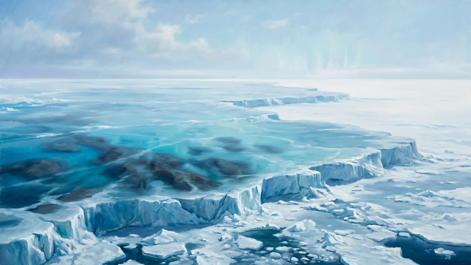
Frozen Sea
A frozen sea in Venalthier.
Gem Crest Bay
A bay in Tornia, Ofrenia.
Gemstone Peaks
Mountains in Mkinti, Erpeus.
Gesichi Mountains
Mountains on Pesalolo.
Gilded Coast
A coastal region on Ofrenia.
Gindrik Sea
Gnarwood Forest
A forest in Old Tolaria.
Goataya
Hills within Shyona.
Gozwin Mountains
A mountain range in Adron.
Grailwood Forest
A forest in Old Tolaria.
Gray Sea
Graymist Forest
A forest in Iylovia.
Greenskin Hills
Grendenheim
Pastoral plains and meadows region.
Greumtuk
Plains in Ve.
Gulf of Joswik
A gulf near Joswik on Ofrenia.
Gulf of Xoth
Gwyrdyr Forest
A forest in Iylovia.
Hagwood
A forest in Iylovia.
Hallenfell
Mountains on Apketrii.
Hana Mosa
A forest within Avalon.
Hashigama
A forest within Shyona.
Hills of Gray Stone
Hills within Shyona.
Hills of Ikaros
Hills of Sharp Talons
Hills in Wycendeula.
Hills of Soromun
Hills in Lier, Erpeus.
Howlwood
A forest in Iylovia.
Ichneum
A forest in the Westwilds.
Inglingi Eror
Hills within Illron.
Jiji River
A river in Nashua.
Karik Hills
Hills within the Grendenheim region.
Kmokosiri
A forest within Shyona.
Koilos Mountains
Koldkin Hills
Hills in the Dragon's Spine Coast.
Krinea Mikea
A marsh in the Wanderlands.
Lake of Rainbows
A lake in the Crimson Coast.
Liar's Lake
Lodrian Hills
Hills in Old Tolaria.
Lucenia River
A river in Gorath.
Mathavia Mountains
A north-south mountain range forming the boundary between the elven territories of the Farlands and the Giant Lands to the east.
Micah Inlet
A sheltered coastal inlet on the eastern edge of the United Free Nations, shared anchorage for confederation traders.
Mighty Mountains
Misery Bay
A bay in the Dragon's Spine Coast.
Mount Tolaria
A mountain in Old Tolaria.
Mountains of Miphoris
Mountains Semaphois
Mylownach
A forest within the Dragonsong region.
Neurian Hills
Hills in Wycendeula.
North Agreben
The northern portion of the Agreben Sea.
North Aphenlein
The northern portion of Aphenlein.
North Suki
A jungle within Chimea.
Nykotheryx Amberylika
A dream-warped subregion of the Rootspire Wilds, lying east of Dalizi territory.
Painted Hills
Hills in the Farlands.
Paradise Inlet
An inlet in L'Coth D'Hari.
Pebble Islands
A group of islands in Tarkhon.
Peleletra Hills
Hills in the Farlands.
Penor Syalki
A forest in Central Aboyinzu.
Plains of Chule
Plains of Eregnar
Plains in Azawahasi.
Plyrthasnyach
A forest within the Dragonsong region.
Pool to Infinity
A lake in the Dalizi Wildlands.
Porcuni
A forest within Illron.
Prisoner Hills
Hills in Malo Kon Greikh.
Providence
A forest within Thorum.
Prowling Hills
Hills within the Crystal Mountains.
Quiet Mountain
See entry under Krenglelan Range.
Resolution Bay
A bay within Turquish Bay.
Righteous Peaks
Ryunimir
A forest in the Westwilds.
Sallow Hills
Hills within Chechol.
Salty Hills
Sarih Plains
Scream Strait
A strait near Pesalolo.
Sea of Reflection
Sea of Spiders
A point of interest in the Sea of Spiders.
Shadewood Forest
A forest in Tornia, Ofrenia.
Shargon Hills
Hills in the Dragon's Spine Coast.
Sherivreen Jungle
Shrieking Peaks
A mountain range in Adron.
Shyaliviin
Hills just south of the Eronia range that poke into the northern edge of the Dunes of Kunagi.
Slonari Bay
A bay within Meadow Sound.
Smokey Hills
A range of hills south of Poum Titch, east of Aal Salma, and north of Chaal Nazzerox that have ceaselessly billowed smoke and ash for…
Snakefoot Hills
Hills within the Grendenheim region.
Sobrevire
A forest in Central Aboyinzu.
Sokorgül
A forest in Central Aboyinzu.
Sonagrev
Hills within the Dragonsong region, home to Dragon's Gate.
Sondoros
The main forest within Qintas, renowned for a strange grape-like fruit-producing vine that grows on the trees throughout the area.
Sopona Fia
A lake within Grustos.
Sothills
Hills in Central Aboyinzu.
South Suki
A jungle within Chimea.
South Wall
A wall in the Thundering Mountains.
Splintercrests
Hills in Wycendeula.
Srendar Mountains
A mountain range in Wycendeula.
Starluck Hills
Hills within Lenora.
Steadfast Mountains
Mountains within Thorum.
Suftos Hills
The contested spine between Klevnaf and Istora: a depopulated no-man's-land that belongs to neither kingdom and is claimed by both.
Sunigama
A forest within Shyona.
Sunrise Mountains
Mountains within Shyona.
Sunset Mountains
Ta Akikis
Tafframel Hills
Hills on Phenol.
Tafleur Wood
A forest on Phenol.
Tanglos Hills
Terü
A forest in the Westwilds.
The Cairns
Hills in Wycendeula.
Thraken Lake
A cold mountain lake on Istora's eastern boundary, which the Istori call the edge of their world.
Tilswyurn Hills
Hills in Central Aboyinzu.
Tishkung Mountains
Mountains on Pesalolo.
Torgan Passage
Traitor Bay
A bay within Chimea.
Tugachi
A forest within Shyona.
Turquish Bay
A bay in Ve.
Untouched Sea
A sea bordering Central Aboyinzu.
Valley of Echos
West Suki
A jungle within Chimea.
Whisper Bay
A bay within Meadow Sound.
Wurm Maw Bay
Wurm Tooth Mountain
Wyrm Teeth
A range of hills in Westrim, east of Kura and north of the Milras Forest.
Xcraya Pallir
A region in Malo Kon Greikh.
Xcraya River Valley
A river valley in Malo Kon Greikh.
Yokani Cliffs
Cliffs within Shyona.