A large island in the Greenwater Isles.
The Rivers of SW Urok
SW Urok is defined by its waterways. The mountains catch rain; the rivers carry it to the sea; and along those rivers, civilization clusters.
Northern Rivers
Pteyalune River: Flows north from the Tethryn Mountains toward Deadwater Bay. Cold, clear water that grows increasingly lifeless as it approaches that cursed shore. Fish swim the upper reaches; the lower river is sterile. Locals believe the Pteyalune once flowed warm and full of life before "something happened" to the bay. Now it carries that death upstream, a little further each generation.
Freolian River: The main water-road from Xi Chin's region southeast toward the interior. Named for the Freolian family, merchant-explorers who first mapped its navigable stretches. Good fishing, moderate current, lined with trading posts. If you're traveling from the Tethryn Mountains to the southern city-states by water, you start on the Freolian.
Myestrones: Less a river than a network—"hundred streams" in an old trade tongue. The Myestrones drain the Pearly Mountains' northern faces, dozens of creeks and brooks converging into tributaries that eventually feed the Freolian. Locals navigate by knowing which stream leads where; outsiders get lost within hours.
Western Rivers
Vyandrik River: The major western artery, flowing from the Pearly Mountains into Phiona Bay. Wide, slow, navigable for much of its length. Fishing villages cluster at its mouth, and shallow-draft boats can travel surprisingly far inland—nearly to the mountain foothills in the wet season.
Prelapon River: Joins the Vyandrik from the south, draining the Pearly Mountains' western slopes. Faster current, prone to dramatic seasonal flooding. The name means something like "after the washing"—supposedly named for a legendary flood that "washed away the old and left behind the new." The Prelapon's floods are destructive but fertilizing; the river-valley farms produce the best yields in SW Urok.
Expation River: Flows down the western coast into Phiona Bay from the north. Local legend claims the name is a corruption of "Expatriate's River"—named by exiles from some forgotten conflict who settled its banks rather than return home. The exiles are long gone, absorbed into the fishing villages, but the name persists.
Central Rivers
Thyogres River: The great central artery of SW Urok. The Thyogres rises in the highlands between the Tethryn and Pearly ranges, flows south through the mountain pass, skirts the eastern edge of Tyberoskos, and eventually reaches the sea near South Reach. It's the primary trade route through the interior—wide, deep, and slow enough for heavy cargo vessels. Control of Thyogres River traffic has been fought over for centuries; currently, no single power dominates, and tolls are collected by whoever holds the nearest bank.
Suverain River: Flows southward through western Tyberoskos, parallel to the Thyogres but smaller and wilder. The name suggests "sovereign"—perhaps once a boundary between territories now forgotten. The Suverain disappears underground in several places, a product of Tyberoskos's limestone geology, making it unreliable for navigation.
Southern Rivers
Peonie River: Flows past Wisgarrd toward the coast, clear water over a rocky bed, famous for the flowering plants that grow thick along its banks. The peonies bloom in late spring, carpeting the riverbanks in pink and white. Wisgarrd's jewelers have drawn inspiration from the flowers for centuries—peonie motifs appear in their oldest and most traditional designs.
Maun River: The river that gives Maun its name—or perhaps Maun gave the river its name; scholars argue. Either way, the city straddles it, connected by bridges of increasing architectural ambition as you move from the outskirts toward the School. The Maun is shallow enough to ford in places but deep enough for small boats, making the city a natural crossroads.
Mneri River: Southwest of Maun, reaching the sea at Threshold. Smaller and wilder than its neighbors, with rapids in its upper reaches that make navigation difficult. The name is old, its meaning forgotten—possibly derived from a language that predates the current inhabitants.
Eastern River
Siddaneas River: Flows along the eastern edge of SW Urok, marking the approximate boundary with Xoth territory. The river is less a border than a convenient reference point—Xoth's influence extends somewhat west of it, and independent settlements exist somewhat east. But when locals say "across the Siddaneas," they mean "in Xoth's sphere," and they lower their voices when they say it.
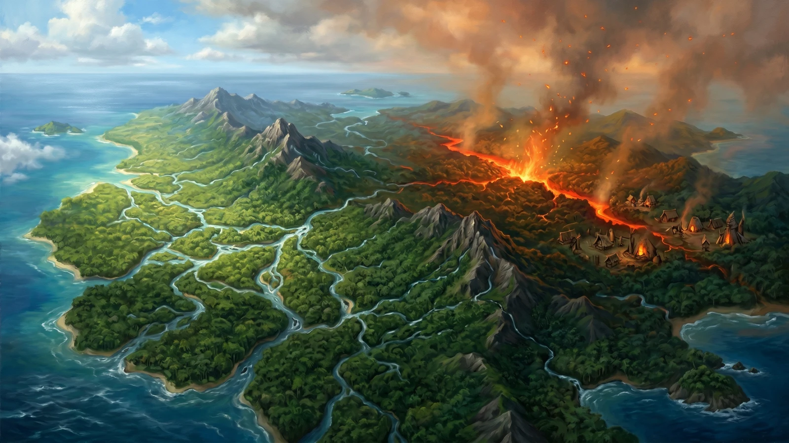
Nekanzi Jungle
The northeastern peninsula of Urok, dominated by dense rainforest split by the Firespine—a surface breach of the Yolus fire leyline. Home to the Neka gnomes, a confederacy of five villages (Tyunigogo, Hyhi, Kanamazi, Yanayazi, and Sygozoki) who have built their culture around negotiating with the fire spirits that emerge from the leyline. The Neka are territorial but trade through Tyunigogo with outsiders, offering fire-resistant materials and distinctive flame-touched metalwork from Sygozoki's spirit-powered forges.
See the full entry in Nekanzi Jungle for details on the villages, the Firespine, and Neka society.