Geography
The Greenwater Isles are a tropical archipelago lying between Upoceax to the west and south, and Rimihuica to the north and east. The region is dominated by the great island of Urok at its center, surrounded by a ring of seas, straits, and smaller island states. Bright teal waters, coral reefs, and lush green vegetation characterize this perpetually warm region.
The Island of Urok (Central)
The largest landmass in the Greenwater Isles, Urok dominates the center of the region:
- Northern Urok: Rainforests and dense jungles
- Central Urok: The Pearly Mountains run east-west across the island's midsection
- Southern Urok: The state of Xoth
Surrounding Waters (Clockwise from North)
Agreben Sea (North): The northern waters of the archipelago, bounded by Mueras to the north, Atriik to the east, and Urok to the south. Contested between the elegant Kendrel Kingdoms along the eastern shelf and Bfaspeen broods in the deeper waters. See Agreben Sea for full details.
The Kendrel Kingdoms—three allied states of aquatic Kendrel civilization:
- Flurin (north): Cosmopolitan gateway, handling most surface trade. See Flurin.
- Glador (center): Traditional heartland, largest and most insular. See Glador.
- Pelaria (south): Volcanic kingdom, fire-attuned and militarized. See Pelaria.
Western islands outside Kendrel territory:
- Crab Island: Home to the pirate city-state of Blackport
- Prophecy Island: Volcanic island with cursed ruins
- Smokestack Island: Active volcano, pyromancer's domain
Shriyen Passage (Northeast): The strait separating Urok from the Ishnit Jungles of Rimihuica.
Gulf of Norag (East): The waters east of the passage, near the Ishnit coast.
Movasi (Southeast): A large island covered by the Dream Jungle, lying between the Gulf of Norag and the Sea of Spiders.
Sea of Spiders (Southeast): The southeastern waters of the archipelago.
Roule (South): An island state south of Urok, home to halflings.
- Roule Channel: The waters south of Roule, separating the Greenwater Isles from Sandreach (Upoceax)
- Gulf of Xoth: The waters between Roule and southern Urok
Bejeweled Sea (West): The waters between Urok and the Farlands of Upoceax.
Chykos Strait (Northwest): Connects the Bejeweled Sea to the Agreben Sea, passing between Urok and the Seacleft Coast.
Neighboring Regions
- West: The Seacleft Coast and Farlands of Upoceax
- North/Northeast: The Ishnit Jungles of Rimihuica, across the Shriyen Passage
- South: Sandreach (Upoceax) across the Roule Channel
- Southeast: The Sea of Spiders, then open ocean
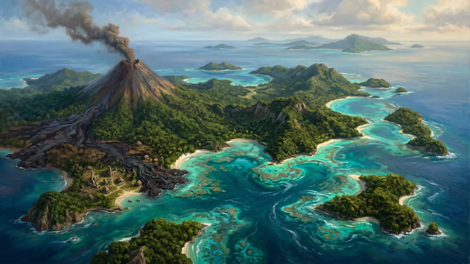
Prophecy Island
Located north of Crab Island and west of Smokestack Island, Prophecy Island was once heralded as a miracle—a volcanic island that rose directly from the sea, seemingly as a gift from the gods to the people. Colonists arrived with hope and built a thriving civilization, believing they had found their promised land.
For two years, the settlement flourished. Then the volcano erupted a second time, burying the entire population in ash and lava. The ruins of Zyquirk village remain visible among the hardened lava flows, a haunting reminder of false prophecy and divine cruelty. Some say the island continues to whisper false promises to sailors who pass too close, luring them to their doom.